Background
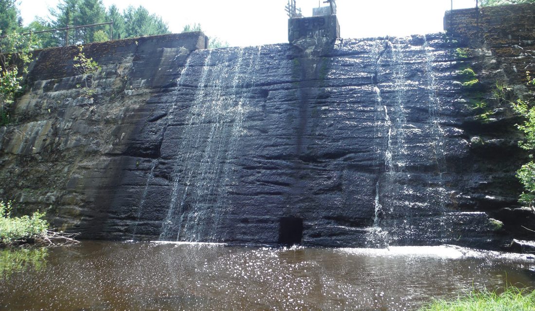
Within Canada’s freshwater systems, aquatic barriers like dams, weirs and stream crossings (e.g., culverts) can disrupt many ecological processes needed to maintain healthy ecosystems and limit the ability of aquatic species to access required habitat. We know that these aquatic barriers are prevalent across Canada, that barrier removal is needed to restore connectivity and access to vital habitat, and that restoration projects are expensive. But we don’t have the answers to some important questions: How many barriers exist in Canada? How much habitat is not accessible for fish and other species? How do we identify the most important barriers to restore and maximize benefits for these species? We need a comprehensive information source to answer these questions, which is where the Canadian Aquatic Barriers Database (CABD) comes in! The vision for the CABD is all of Canada’s barrier and connectivity information in one place – easily and openly accessible.
The Canadian Wildlife Federation (CWF) is leading the development of the CABD that will support conservation efforts to improve freshwater connectivity across the country. Version 1.0 of the CABD (CABD 1.0) was officially launched September 25, 2022. The CABD currently comprises four types of data across Canada:
- Dams
- Waterfalls
- Fishways
Additional barrier types (e.g., stream crossings) will be compiled and released in subsequent years.
Is the CABD 1.0 a perfect dataset? No! Data gaps exist in our datasets - we are going to be missing structures and need to fill in attribute gaps for the majority of existing points. For CABD 1.0 we have relied on compiling existing spatial data sources and performing de-duplication, geolocation, attribute mapping (i.e., bringing in and tracking attributes that come from various sources for an individual feature), and standardizing to the CABD data structures. As such, while not perfect, the CABD datasets do represent the most comprehensive information source for dams, waterfalls, and fishways in Canada in a curated, standardized, and central repository.
However, we are working hard to begin to fill those data gaps by reviewing non-spatial data sources (e.g., reports, scientific studies, websites) that can provide additional information for structures. New data releases will be announced on our What’s New page, so that you can always stay up to date with the latest versions. Filling these data gaps is a huge job and we’re hoping people across Canada can help! We’re working on some new tools to allow users to submit information through the CABD web tool, but in the meantime check out our Submit Data Updates page to learn how you can help us fill these data gaps. We’ll release data updates periodically with new information, so stay tuned for future release announcements! ! If you’d like to receive email notifications when a new data release is available, send us an email at cabd@cwf-fcf.org.


Accessing the CABD
The CABD web tool can be found at aquaticbarriers.ca; check it out today! The web tool allows users to explore and visualize the barriers, view associated attributes, and filter and download the data for further exploration. To learn more about the CABD, how to use the web tool, explore our data sources, and how to help us fill data gaps, check out the CABD documentation site.
The Canadian Aquatic Barriers Database is a multi-year project that is supported partially by financial contributions from Fisheries and Oceans Canada.
The Canadian Aquatic Barriers Database is also funded in part by the RBC Foundation in support of RBC Tech for Nature.
Videos
Program Goal
The CABD is being developed, in collaboration with partners and engaged stakeholder, to help improve fish passage within Canada’s freshwater systems. The database and associated online tools will support habitat status assessments and reporting, management and regulatory decisions, restoration planning and prioritization, infrastructure asset management, research and monitoring programs, and education and public outreach initiatives.
Four Project Areas
Engage & Collaborate
The project aims to collaborate and actively engage with interested parties, potential end-users, and data providers, to provide feedback for the development of the CABD and ensure the tool is useful for a wide range of users. Stakeholders include representatives from all levels of government, NGOs, local and community groups, researchers, and industry.
Aquire & Share
We are building data sharing relationships with public and private organizations to create a central warehouse from which standardized data can be incorporated into the CABD and reshared with providers over time.
Building Tools
User-friendly web-based analytical tools are being built to help decision makers prioritize barriers and allocate resources for barrier remediation.
Ongoing Support & Sharing Success
The project aims to provide users with ongoing support to make resource management decisions and a media platform to share success stories with their communities.
Frequently Asked Questions
A: The CABD is a standardized database of barriers to freshwater connectivity across Canada being developed by the Canadian Wildlife Federation. The database is designed to support assessment and reporting on the status of habitat connectivity and inform management and regulatory decisions relating to infrastructure construction and management. It also supports barrier restoration planning and prioritization of projects to improve connectivity and fish passages for important species and research and monitoring initiatives to better understand the effects these barriers have on freshwater ecosystems and the species they support. Additionally, the CABD will provide a national forum for sharing resources, best practices, and success stories to support education and public outreach. If you have questions, comments or feedback you can contact us by e-mail at cabd@cwf-fcf.org.
A: You can access the CABD through any browser by visiting https://aquaticbarriers.ca/. Additional software is not required to explore the data. If you'd like to use software like Google Earth or ArcGIS to explore further or perform analyses, the data is available for download through the web tool in a variety of file formats. Visit our documentation site for instructions on how to download CABD data. Please note accessing the CABD web tool using an iPhone is not yet supported. The web tool can still be accessed from Android mobile devices and some Apple mobile devices (e.g., iPad).
A: Data related to dams, waterfalls, fishways, and hydrographic (stream, river and lake) networks are currently available. For each dataset, we've compiled a set of information describing features that can be used for further analysis, such as dam use, construction type, waterfall height, fishway type and construction year. A complete list of attributes can be found in the Data Catalogue.
A: The data in the CABD has been compiled from a variety of existing datasets, either via open-data licenses or data-sharing agreements. CWF is also working hard to identify additional data sources that can be used to fill data gaps. For a full list of our data sources, please visit our Data Sources page.
A: We encourage you to use the CABD and its data for any projects where you need high-quality data about barriers and stream networks. Some opportunities to use the CABD in your work might include:
- Assessing and reporting on the state of fish and fish habitat in a watershed
- Prioritizing barriers for remediation to improve fish passage
- Monitoring the effectiveness of fish passage improvement projects
- Creating an inventory of barrier infrastructure locations and conditions
Data in the CABD is made available through the CC BY-SA 4.0 license. This license allows you to share and adapt this data, as long as you provide proper credit and distribute any derivative data under the same CC BY-SA 4.0 license.
A: You can download barrier data by using the “Filter” and “Download” windows in the web tool. The download window allows you to download a filtered subset of data or the entire dam, waterfall, and fishway data layers in either Shapefile, Geopackage, KML, or CSV format. Visit our documentation site for instructions on how to download CABD data.
A: We're working on adding support for downloading hydrographic networks. Until this feature is complete, please send us an e-mail at cabd@cwf-fcf.org that includes the area where you want to download hydrographic networks, and we will send you a copy of the data for that area.
A: We’re working on a few key updates to the CABD including filling data gaps, adding easy-to-use tools for users to submit data updates, adding new barrier types like stream crossings, processing clean and connected hydro networks to support barrier prioritization analyses.
A: Absolutely, anyone can contribute to the CABD! If you know of a barrier dataset or barrier that you don't see in our database, or have information about existing barriers, please reach out to us at cabd@cwf-fcf.org. For more information about how you can contribute data to the CABD visit our Submit Data Updates page.
A: The CABD is currently only available in English, but we plan to release a French version in Fall/Winter 2022.
Updates
September 2022
We are please to announce the release of CABD 1.0, which includes complete national coverage of dam, waterfall, and fishway data in Canada. You can now explore, filter, and download the data through the CABD web tool! We’re continuing to work hard to fill data gaps and incorporate additional barrier types (e.g., stream crossings) in the CABD, so stay tuned and check back here periodically for new updates and data releases.
Did You Know?
There are more than 15,000 dams in Canada, according to the Canadian Dam Association.
Not all barriers are bad, some are in place to conserve our freshwater systems by limiting the spread of aquatic invasive species.
Nova Scotia is home to the only operational tidal generating stations in North America.
In the News
-
Kitigan Zibi Anishinābeg calls for safe passage for American eels on the Ottawa River
December 3, 2024 - The western Quebec First Nation is urging the provincial and federal governments to protect American eels from dangerous practices at dams in the upper St. Lawrence River watershed that have severely curtailed their population.
-
Project aims to build high-value habitat for fish in Mill Creek
August 1, 2024 - An old concrete bridge was removed this week in a section of the Mill Creek in eastern P.E.I. The goal of the project is to make an easier passage for fish in the river, including Atlantic salmon.
-
Fish are swimming a bit easier in this P.E.I. creek thanks to bridge structure removal
August 1, 2024 - The Souris and Area Branch of the P.E.I. Wildlife Federation is spearheading the work, with support from the Canadian Wildlife Federation, the Atlantic Salmon Federation and the provincial government.
-
Cross Creek Fish Passage Restoration
March 22, 2022 - Cross Creek — Nedut’en of the Witsuwit’en Lake Babine Nation — runs through the center of Pendleton Bay Provincial Park.
-
The Aquatic Barriers Interactive Web Tool Launches, Starting With Alberta
December 21, 2021 - The Canadian Wildlife Federation is pleased to announce the public launch of the Canadian Aquatic Barriers Database (CABD)!
Get Involved
CWF is working with external partners to identify existing barrier datasets and improve the CABD’s national data coverage. Please complete the form if you or your organization are in possession of any additional barrier datasets or are interested in collaborating with CWF to help fill data gaps and improve freshwater connectivity across Canada.
Program Lead
Nick Mazany-Wright
Nick Mazany-Wright works at the Canadian Wildlife Federation as a Spatial Ecologist. Nick has a background in geospatial analysis and the restoration of freshwater and wetland ecosystems. His work includes using geospatial models and conservation planning tools to assess, prioritize and restore freshwater connectivity in aquatic ecosystems.
“The restoration of freshwater connectivity and removal of aquatic barriers is a vital part of promoting the recovery and conservation of fish species across Canada. Tools that allow us to strategically prioritize where we spend scarce restoration resources will ensure that we are targeting barriers for removal that will maximize benefits to fish.”

Learn More


- 0
- 1
- 2
- 3
